Thursday, September 27, 2007

More of the same just not AS hot

Yesteday, IAD broke a record by hitting 93 which is unbelievable for this time of year. What is also unbelievable is the lack of rain we have had all summer. We may get a shower or two tonight but there is nothing in the modeling that gives us any hope for real rain anytime soon. Also, it appear that for this upcoming winter, we are going to have a La Nina which if it gets too strong might really ruin winter here for us. More in that later but dont panic..we still have some hope for a decent winter.

But again, it looks like today is the last really hot day we will have of the year as a cold front does come through tonight and take us back to near normal for the weekend. We are not going to see any below normal temps as long as the pattern is what it is. Trough in the west and a Ridge in the East. We will stay normal to above normal until the pattern shifts and again nothing rainwise for the next week

Wednesday, September 19, 2007

Not much going on

No rain to speak off. Temps are very comfortable. It will probably climb to the low 80's towards the end of the week and we could get downright really warm for Sept early next week but that looks to be short lived. I dont like our rain chances for the rest of the week or early into next week. Story of the Summer

Really...there is nothing going on right now worth blogging about.

Wednesday, September 12, 2007

Its a beautiful day


The heat and humidity that has been so persistent has taken a hike and has been replaced by much drier,cooler and less humid air. This will be the dominant feature for the next 7 days as today is the first shot of cooler air and then an even more impressive cool shot will occur over the weekend where highs could be in the upper 60' and lows in the 40's in the N and W Burbs.

I am going to start posting more now as we start to head into winter. I will update the blog later with our chances for rain and hurricane potential.

Friday, September 07, 2007

The Hurricane Threat is a bust

Terrible forecasting by the models and by the people(like me) that use them lol. The usually reliable ECMWF backed off a few days ago and the GFS looks like it might score a coup here as it was never impressed. So very disappointing for alot of us who needed the rain and some fun. The high Shear really took away any chance for the blob to develop. Its not even a depression yet. It may eventually become a tropical storm but the serious threat is definitely gone.

The heat isnt a bust though and it dosent want to go away. The warmth will continue for a good part into next week before some REAL FALL Weather comes and gives us big relief by next weekend maybe.

Tuesday, September 04, 2007

Sneaky Hurricance to hit the SE Coast?


While our 2nd Category 5 hurricane in the past few weeks is creating Havoc in Hondurous, the models are now developing an area of low pressure off the SE coast which has it intensifying and actually hitting the SC coast a Cat 2 or 3 Hurricane. The 00z European models shows this nicely as a 1004mb low SW of the SE coastline intensified as it hits land. If this were to happen, we could be talking about major winds and flooding for the East Coast. The European has shown this solution now twice in a row. The GFS has it but its much more of a sheared look and is not threatening in the least. This is something major to watch and could really affect the weekend. Behind the potential event, there could be a impressive rush of cool air for next week but at least for this week until we resolve this situation, it will be warm and dry

Monday, August 27, 2007

Im back...thankfully the heat isnt

I took a break from the blog from a while...but Im ready to go again. Fall is just around the corner and we actually got some decent rain last week so things are changing just a bit. Saturday was brutally hot and oppressive but I dont see that kind of weather happening anymore this year. Not like that anyway. There maybe one 90 degree day this week but this weekend will actually be really nice tempwise. As far as rain, we had our rainiest week this past week in a long time as most of the week was damp and cloudy. Hurricane Dean ended up being a Category 5 monster but it completely missed the United States.

This week is going to be boring...no rain and temps around normal. No sign of any Cane ready to hit the United States.

Thursday, August 16, 2007

Rock me like a Hurricane


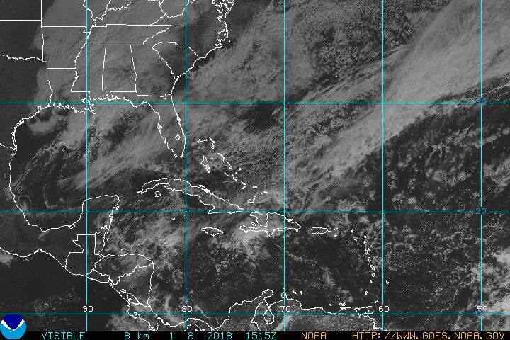
Well the models were right in that a hurricane did form in the Atlantic. The hurricane is now known as Hurricane Dean. Where Dean will go is the big question. Here is the current location of the Cane.

Most models right now have this baby hitting the Yucatan and sparing the United States. Previous models runs had this storm all over the place hitting places ranging from Houston to New Jersey lol.

Ill update you after the 12z model runs but a few of the newer model runs are hinting at the possibility of a more northern turn and possibly being a threat to the Gulf States.

Friday, August 10, 2007

Another Warm Week but Changes may be coming

So far every day this August has been over 90 degrees as Dulles hit 96 last night. We will probably hit the mid 90's again today but not reach 100 like I thought earlier in the week but after that, we do get a brief relief as we stay in the 80's for the weekend.

Next week is shaping pretty warm again(not as hot as this past week) but there are changes coming and by the end of next week, we could actually be seeing temps below normal(early fall preview) as a trough sets up over the East.

There is also more and more noise in the modeling regarding the possible development of a hurricane. Both the GFS and the European show a hurricane by day 10. Lets see if it develops first and then we can start worrying about the track or whether it will recurve.

Wednesday, August 08, 2007

DCA at 102 at 2pm

IAD is still 99--we need to get rid of the clouds. ETA mos has IAD at 104 which would break the all time record but those darn clouds!

We have another chance at 100 on Friday and then we get some much needed relief. Maybe only upper 80's on Saturday!

Tuesday, August 07, 2007

The Struggle to 100

The ETA Mos(guidance) is down a bit from what it was yesterday and has forecasted us to hit 98 degrees today but with humidity, the heat index will be in the 105 range. If its going to be this hot, lets go for 100 and break some records. My forecast now is 99 at IAD. Tomorrow, is looking equally as hot as the ETA MOS is 99. I believe we will hit 100 in the next 2 days.

We will probably get some relief over the weekend but still plenty warm. Not oppressive though. the 00z GFS run showed a full latitude trough by 10 day which would take us to below normal for a few days but its too far out to say anymore about it and it dosent have support from the European.

Also, the models are starting to show some "noise" in the tropics. Still no signs of development but we could start seeing some activity in about 10 days. Stay tuned!

Monday, August 06, 2007

Can we hit 100 on Tuesday?


So far, every day this August has hit at least 90 and its been mostly mid 90's. Tuesday, we have a chance to rock and roll and hit the magic mark of 100.This will definitely be our best chance of the summer. So to recap, today will be upper 90's. Tomorrow, we will probably achieve the rare magic mark of 100 and then Wednesday we will probably low to mid 90's. No major rainstorm as usual but there is always the threat of a thunderstorm or showers in the afternoon. We got a bit of rain overnight but definitely nothing that would even make a dent in our drought.

There is one bit of good news. There is a chance that a trough develops in the East at the start of next weekend which could over us relief from the relentless heat we had the past week or so.

Still nothing in the tropic to get excited about

Thursday, August 02, 2007

Could be a long stretch of 90's

if the models are correct and they are really bringing the heat, we could see a very long stretch of 90 degree days in a row. Next week is looking brutally hot and no rain is in sight. The worst of Summer is coming

Wednesday, August 01, 2007

Hot,Dry and Boring

Really nothing earthshattering to tell you. August is here and it looks like the dog days of Summer are upon us. Most days for the forseable future will be in the 90's with a shot at upper 90's next week. This weekend cools a bit but will still be very warm. As far as rain, I hope you enjoyed what we got during the weekend because there is nothing coming. The rain over the weekend was a letdown and much less than what the models were adversting 3-4 days before hand. The drought wins again.

July is over and the average temp will starting going down from now till February so Winter is coming. Lets take a look back at July for IAD and DCA

IAD finished July about 1.6 above normal with a high of 97 on July 9. We had 13 90 degree days which was up from 8 in June. Not too bad. Somehow it rained 1.75 inches which was way below normal(1.82). The weekend storm gave us nearly an inch in about 4 days. We had one day where the high temp was 79! There was no snow

DCA finished July at Normal with a high of 98 on july 9 and 10. DCA featured 14 90 degree days. DCA got alot more rain than IAD with 2.40 inches but still 1.26 below normal. DCA also had an inch from the weekend event. July 29 was the wettest day at DCA with .98 inches


Still no signs of any hurricanes

Wednesday, July 25, 2007

12z GFS shows Big Rain for DC area

the new GFS is very bullish on a slow moving rain event that would give us quite a bit of rain over the course of 4 days.

Here would be the total rain amount if it verified through August 2nd. It would make a huge dent into our drought

If this were to happen and its looking like a decent chance, the majority would fall early next week with it starting late in the weekend. I will keep you updated

Rain on the way? Ive heard that before

its really amazing how the rain keeps dodging us especially in eastern Loudoun County but there are signs that a stalled out front could bring us some substantial rain for the weekend. The Latest gfs runs wants to give us about 2-2.5 inches of rain over the next 5 days with most if falling off and on during the weekend. As we get closer to the potential event, i will keep you updated. However, this is far from a sure lock because we are in a drought and the rain has been finding a way to miss us.

As far as temps go, we havent hit our normal high for about 5 days and although it will get somewhat warmer, im still not impressed with the chances of any real heat wave for at least the next week although we could hit the low 90's thursday and Friday.

Hurricanes? Nope...nothing in sight.

Friday, July 20, 2007

Cool Stretch coming

The heat is going away for a few days and will be replaced by some nice fresh cool weather from Canada. Highs well below average and cool at night. Its going to feel like early fall rather than middle of Summer.

By this time next week, the heat should be returning and there is "talk" of a big Heat Wave. Well see...im not impressed yet from what the models are showing.

rain? Forgetaboutit. Drought City Baby! In all seriousness, we could see something early next week but Im not putting my hopes in it. Not yet.

Wednesday, July 18, 2007

Storm Cancel again..the Drought wins again

well, the storm that appeared to maybe give us a chance for some rain this weekend is heading way north of us so we will be lucky to get a few drops. The good thing is the temps will be much cooler this weekend and into the early part of next week. By Wed, we should start to see another warmup.

Once your in a drought...its really hard to get it to rain.

Monday, July 16, 2007

Possible Storm this Weekend?

It looks like another mostly dry period with most of the heat occuring in the 1st part. Tuesday looks to be the hottest day as we could hit 95. There is a chance for Thunderstorms pretty much everyday this week but as usual, they will be hit and miss.

The big change could come as we head towards friday with the possibility of some stormy weather and cooler temps. I will update later after the 12z model runs.

Wednesday, July 11, 2007

Storm Cancel

My old friend, the European model let me down as it took away the storm that it had for us for tomorrow. From my last Monday post, it had a pretty potent storm developing in the Gulf and coming up the coast but unfortunately, thats not going to happen and i should of waited to see at least one more run before mentioning the possibility.

There is a chance of showers and storms tonight and the weekend will be pleaseant(So there is some relief coming) before the next round of heat arrive early next week. The European does have a little wave to the south of us on Friday that could give us some rain so ill check on that in more detail.

Weekend looks pretty nice!

Monday, July 09, 2007

Heat Wave but relief coming?

STORM POTENTIAL ON THURSDAY

Searing Heat for the next few days as highs will most likely hit near the 100 mark today and Tuesday. I expect to flirt with and reach 100 degrees both days.

But there is relief in sight....a stormier pattern may be in the offering and we could see a couple of storms towards the end of the week that might give us some much needed rain and temperature relief.

In fact, the latest run of the European has nice storm developing in the Gulf States and heading up the Eastern Seaboard for Thursday and Friday. That could give us the rainy day we have all been looking for. Behind that is another possible storm developing down south that could give us another event during the last part of the weekend. But thats 7 days away. Our best chance appears to be Thursday and Friday.

On Wednesday, we will start seeing temp relief as temps will drop back into a more tolerable range. Stay tuned for updates on the storm!