Thursday, November 30, 2006

First Major East Coast Snow Threat

is not going to be Monday/Tuesday as that storm looks safely out to sea. Our first real threat is Dec 8-9 from some energy that will be coming out the Pacific Northwest. Obviously its a long way out but this has alot of potential.

Dont forget..tomorow will have rain/high winds/warm until the cold front passes. Once that happens, Winter will lock in till about Dec 11-12 before it warms up again. Cold next week and the chance of a major storm.

Wednesday, November 29, 2006

Chicago looking at a historic snowfall event

I ususally dont post about the midwest, but the models are looking very impressive for a potential Midwest snowstorm that could reach historic levels in chicago. The storm track is now a bit west of where it was yesterday and its printing out unbelievable snowfall rates in Chicago where they could pick up 12-18 inches of snow.

For us--we will be warm with a possibly stormy(Rainy) Friday before the cold front comes through and drops us to below average by Saturday

models are trying to do something snowy monday for the east coast but right now its showing the storm out to sea. Looking pretty cold for all of next week

Tuesday, November 28, 2006

Warm End to November-Cold Start to December


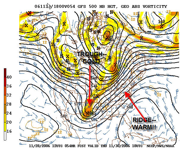
Well well well, a dominant Ridge has setup shop in the Southeast pumping really warm temps for the last week of November. However, things will be changing by Friday/Saturday as a cold front will come through again, and drop temps back to more December like levels. In addition, models are also showing arctic air that will be transported south from Canada for next week .So..it appears that the first week of December through about Dec 10 will featurecold air and the chances for 1 or 2 snow events. So warm this week, cold next week and we have to watch for 2 chances for snow in the Dec 1 to Dec 10 timeframe. I am confident the I95 corridor will have accumulating snow by mid December

The cold front traveling the country this week will spawn a storm…the question is---where does the storm go. As it appears right now, The ohio valley could see the snow while the East is on the warm side of the storm. So before we get cold, its going to rain

How is december looking?

Dec 1-10 cold with a chance of a snowstorm or two

Dec 10-20 Warming up to normal to above normal

Dec 20-31 Stormy and seasonable temps. We could see a nice storm in this time frame

Wednesday, November 22, 2006

Quick update on Storm--I95 Special


The storm is now starting to move up the coast. Rain is on the doorstep. The good news is that the timing of the storm is earlier than I thought so the heaviest rain will be this afternoon through tomorrow morning. By Dinner tomorrow night, it should just be damp/cloudy. Rain will be heavy through the overnight so not a great night to travel. The best rains will be East of I-95.

After that--we go back to a mild period and await a possible Brief Arctic Shot around Dec 1. That shot could give us our best chance yet for accumulating snow. Have a nice Holiday.

Btw...how ununusual was yesterday's storm?

http://www.usatoday.com/weather/news/2006-11-21-florida-cold_x.htm

Tuesday, November 21, 2006

Storm track still uncertain


Look at the radar...looks like wintry precip is falling as Far south as South Carolina...

Im still not 100% convinced this storm is going to nail us with rain on Thankgiving...some models are still trying to push this storm east which would put the heaviest rains east of the big cities. The storm isnt looking as wet today as it did yesterday so I will keep you update.

Dec 1-3 timeframe is looking pretty interesting. More later.

Monday, November 20, 2006

Big Weather Changes

Folks,

If you remember last week, i talked about cold air for the first part of the week and storm forming in the Atlantic that might give us a bit of snow. At the time, the models had the storm missing us and being too far to sea. Well, things have changed but were still not getting snow. The storm will form off the Florida Coast tonight and possibly give the Carolinas some snow. Then we watch the storm Slowly..and I mean slowly go up the coast. By the time its ends up affecting us, the cold air is long gone and we are into Thankgiving. So yes, now Thanksgiving looks cloudy,cool and Wet. And So does Black Friday. This storm could last for 2-3 days! We could be looking at alot of rain/wind in this time frame. Had the cold air stuck and this was January...this would of been a historic event. So it looks like South Carolina and North Carolina could see a bit of wintry mix this week but not us to the North. Strange.

Anyway...after that, there are some signs of some wintry action around the turn of the month but thats a far way off. I do not think December is going to a be a particulary cold or snowy month. I think real winter for the east Coast this year will start in Late december or early January. I think December will feature more roller coaster weather.

Wednesday, November 15, 2006

Stormy day tommorrow

Once again, the late el Nino fall is producing another impressive storm. The storm center is heading straight for the Ohio Valley. We will be on the east side of the storm so our rain wont be a constant rain but will come in the form of possible severe thunderstorms. So, tomorrow expect T-storms and high winds with possible damage. On the flip side, on the west side of the storm, snow is possible. Chicago will see there first snow tomorrow but no accumulations. Temps will begin cool this weekend as the rollercoaster temp swings continue. Monday and Tuesday look very cold(about 15 degrees below normal) and we have to watch another possible storm that could produce moisture in that cold air. The models have the storm early next week right now too far out to sea to affect us but it needs to be watched.

Moderation reconvenes on Wendesday and Thankgiving is still looking nice and about 60. Look for rollercoaster weather for the balance of the month.

Monday, November 13, 2006

Severe Weather on Thursday?

This certainly has been a stormy fall which is not suprising considering the El Nino is now well underway. It seems like we have had a big storm every week for the past 6 or so weeks. This stormy weather will continue through the winter but with much colder air in place, we should expect several impressive snow events. The next event to focus on comes thursday as a powerful storm heads west of us blasting into the ohio valley giving the eastern US a good chance of rain with possible thunderstorms and wind. Temps starting tomorrow will moderate again. However, there are signs of some really cold air coming down late this weekend setting us up for our first possible.....stay tuned.

ps--the cold air will be temporary and we should start warming up towards thanksgiving. Right now my forecast for Thanksgiving is clear--near 60. Well see.

Friday, November 10, 2006

Yes--More Rain on the way

On Nov 11,1987 forecasts were for showers and 40's. 12 inches and and a beltway shutdown later, the DC area received its biggest early season snowfall in recorded history shocking many people and sending meterologists to their resume writers.

This year....no so much

Warm Weather as advertised from way last week is here now here but will soon be leaving as another storm approaches Sunday. Temps will be warm for one more day before we get a raw chilly rain on Sunday. Sunday will be around 51-52 degrees.

For next week--temps should be normal to slighlty above. I thought last week, that it could get interesting around Thankgiving but I am backing away from that for now

Again--more rain to deal with

On Nov 11,1987 forecasts were for showers and 40's. 12 inches and and a beltway shutdown later, the DC area received its biggest early season snowfall in recorded history shocking many people and sending meterologists to their resume writers.

This year....no so much

Warm Weather as advertised from way last week is here now here but will soon be leaving as another storm approaches Sunday. Temps will be warm for one more day before we get a raw chilly rain on Sunday. Sunday will be around 51-52 degrees.

For next week--temps should be normal to slighlty above. I thought last week, that it could get interesting around Thankgiving but I am backing away from that for now

Tuesday, November 07, 2006

More Rain

In my last post on Friday, I said we need to watch for a mid week rainstorm and then a nice warmup following the storm. Well folks, nothing has changed. Expect Rain-Heavy at times tonight into tommorow morning. For PA up to New England, the bulk of it will fall tomorrow. Again..another impressive storm with 1-2 inches. The eastern sections will get the heaviest rain.

After the storm, an impressive warm up for the weekend. We could see 70 degrees in the Thurday/Friday timeframe. Next week will start warmer than normal but well have to watch that really cold air thats building in Canada to see if it may pay a visit late next week

Friday, November 03, 2006

Cold Weekend-but Warm Next Weekend

Well, the cold air has arrived as advertised but the heart of the cold will be from tonight through Sunday. Tomorrow night will be the coldest night since last winter. Daytime highs most likely wont break 50 with upper 20s to low 30's for night time lows. The cold air will start to lift out on Monday as we get a slight moderation. We have to watch out for another rain storm by the mid week.

For all you fans of warm, next weekend is looking kinda toasty as a nice warmup ishould be present at this time next week. The warmup should start about Thursday of next week and last about week but there are signs of major cold air building in Canada and also The Greenland Block developing. For those who have been reading my weather emails the past few years, you know my saying--Greenland Block--cold air locks. Basically, its high pressure that builds over Greenland that locks cold air in the eastern United States and correlates nicely to an amplified stormy cold pattern.


With all that being said...after November 15, the pattern is looking very interesting but its still a way off. Have a great weekend