Friday, December 29, 2006

Our Winter may have a pulse


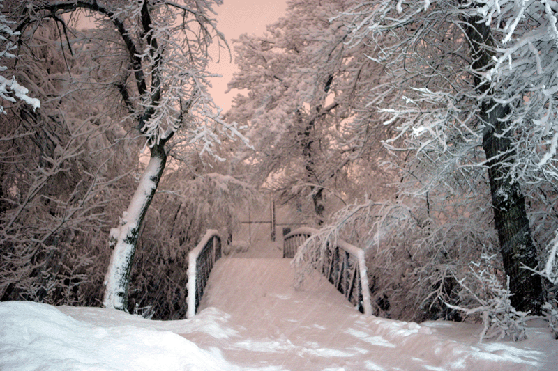
Boulder, Colorado a few hours ago...Remember what snow looks like?

We are currently in a very stable pattern where the same things keep happening over and over. Denver is getting another blizzard right now and we are above average warm with another rain event on the way for New Years Eve and New Years. This is the rinse and repeat pattern and there is going to have to be a serious jolt to change it.

Well..some of the modeling is showing signs of the jolt occurring and its a pretty strong signal but not overwhelming yet. So right now my forecast is for the pattern to start changing in about a week and we still start to see the effects between Jan 10 and 15. It is possible that between January 15 and February, we could see some harsh stretches of winter based on climatology related to weakening El Nino and the modeling. If you remember February 2003, the DC area had about 35 total inches from 3 storms so its possible to get alot of winter in a short amount of time. So yes...i am seeing signs of a pattern change but Id like to see a few more days of data before I fully commit.

And make no mistake, we will blowtorch before the pattern changes. Temps the first 10 days of January will be WELL above normal.

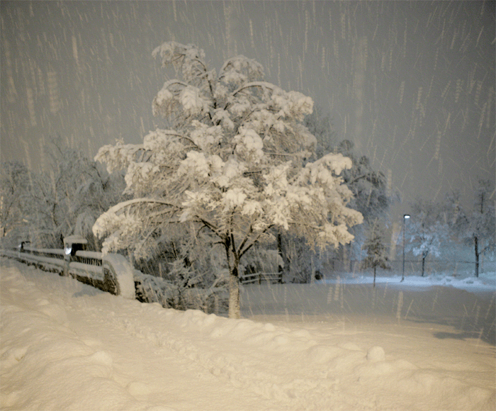
For those of you that forgot what snow looks like...here is another picture from the current Storm in Boulder,Colorado

Wednesday, December 27, 2006

The blowtorch is coming back again

The global warming pundits are going to have a field day for the next week few. The models show an incredible warming in Canada resulting in yes...another blowtorch for the Eastern and Central United States. Folks, there is no cold air anywhere in sight and my winter forecast is in danger of busting really badly unless we get a turn around starting in Mid January. But for the next 10-15 days expect much warmer than normal conditions. There might be one or two cool days thrown in there but if i dont see anything that resembles a pattern shift by this time next week, I may have to concede and call this a year that we dont see a winter.

Thursday, December 21, 2006

Is Winter Over?

Strange question to ask on the first day of winter but we will answer that question shortly.

First of all, sorry about the lack of updates. Was away in NYC for the first part of the week. Well, it dosent appear that we are going to get a white Christmas after all. I said in my last email that it will get cooler but the air source will not be arctic in nature which means we need a perfect storm track to get snow. Even though we are going to be in a stormy pattern, its not a particulalry snowy pattern. It appears that this weekend will feature a rainstorm(Friday-Saturday) and then there will be another storm on Dec 26-27. The details of that storm are still in question again without really cold air in Canada, you need a PERFECT setup for snow when your cold air is limited. There could be another storm shortly after that but again....very questionable as far as snow.


So back to my question? Is Winter over? I said in my winter outlook that December will be the warmest and least snowiest month of this season. Most El Nino winters start off slow and they really pick up steam in January and February. In 2002, December was very similar to this December. First 10 days were cold and then it was very mild till the first week of January. After that winter locked in and was relentless through the end of February and we had historic snowfall amounts. So---Im not pulling the plug.

Thursday, December 14, 2006

Holiday Heat

If you think temps in December in the Mid Atlantic and Northeast cant get warmer than they have been….your plain wrong. I believe at some point early next week before it does start turning colder and yes it will be colder as we head into Christmas Eve and Christmas, is that DC could hit 70 degrees. It will be cooler up north of course but I think the DC area is primed to hit some record highs before this air mas vacates. This is a very impressive warm blast that should continue up until the 21st.

But despair not if you like your Christmas cold. As confident as I was with this warm blast coming, I’m equally as confident that we will start to feel winters’s chill heading into the Christmas Eve/Christmas and there is a reasonable chance for a White Christmas now based on the timing of the pattern change. Im not talking about artic cold or record cold but Im talking about seasonable cold that could spell snow if the storm track is right.

Tuesday, December 12, 2006

Dreaming of a White Christmas?

You thought I was going to say Keep dreaming right? But there is some hope. Before I get into that, I had a few emails from folks discouraged about my warm forecast in the next 10 days. I also got a few that are very happy about the warmth that is coming but for those who are bummed about christmas shopping in tee shirts--there may be hope.

starting sometime around Dec 22-23, there are signs of a slow pattern change into a colder pattern. Models have a very threatning look for around Christmas Day so we really need to watch this. But until then, Mother Nature is going to keep the blowtorch going. Im thinking early next week is pretty warm with maybe a record or two being broken. There is a chance for some showers tomorow but not a big deal.

Friday, December 08, 2006

Its begining to look alot like........

labor day! Say the models. Folks, after this weekend, mother nature is going to turn on the blowtorch especially for the week of Dec 18-22 where record highs could occur due to the pacific jet brining mild air into the east and the reformation of the Southeast ridge. The warming will start this sunday and last until a few days before the christmas. I dont anticpate next week being that much above normal but the week after could be very warm for a few days.

If your looking for winter weather, stop looking. Its not happening till after Dec22. Im still on board for a cold stormy January and Feb.

Tuesday, December 05, 2006

Its cold--and gonna get colder

Its cold today but cold without snow is like cereal without milk. It just dosent taste as good. The problem is, its going to get colder and feel more uncomfortable and yet we will still be without snow unless you read the blog of some other meterologist who think a memorable storm is on the way. Ive learned to live with the fact that whatever some meterologists predict, the exact opposite will happen. If you really want to trust a forecast, make your own lol. Anyway...cold will continue this week with a reinforcing shot of cold air this weekend. European model has 850 temps in the deep pinks over DC.

After that, we do see a warmup? My best guess it that it will be prolonged and we wont see a chance for wintry weather till sometime around Christmas. The warm will be prolonged but I dont think we are talking record breaking.

Monday, December 04, 2006

Very Cold Week but its only temporary

Very Cold week ahead….but moderation is coming

After finishing with one of the warmest novembers of all time including 6 straight 60 degree days to end the month, these past few days and the rest of this week are probably shocking your bodies. Ive mentioned this alot lately and Im not sure what it means but we are continually getting months that are considered "the warmest of all time".

Anyway, Cold this week with a very cold shot for the weekend. The models have backed off the storm threat I mentioned last week but there is some available energy with cold air that needs to be watched. But for now, Im taking the threat off the table. After the weekend reinforcing shot of cold air, we warm up big time and probably stay warm till around Dec 20-24. The Last week of December could be cold/snowy and Im still looking for a cold snowy January and February. But if you like warm decembers, the next few weeks after this week are for you.